Built by Pilots, for Pilots
A free, non-commercial, and open database for airfield reports for general aviation worldwide.
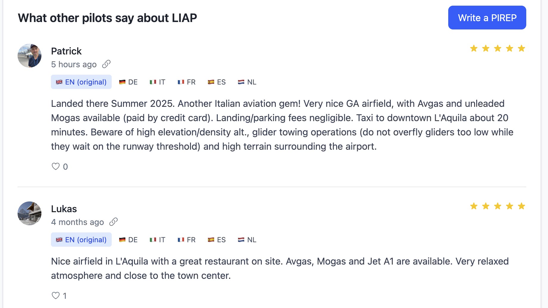
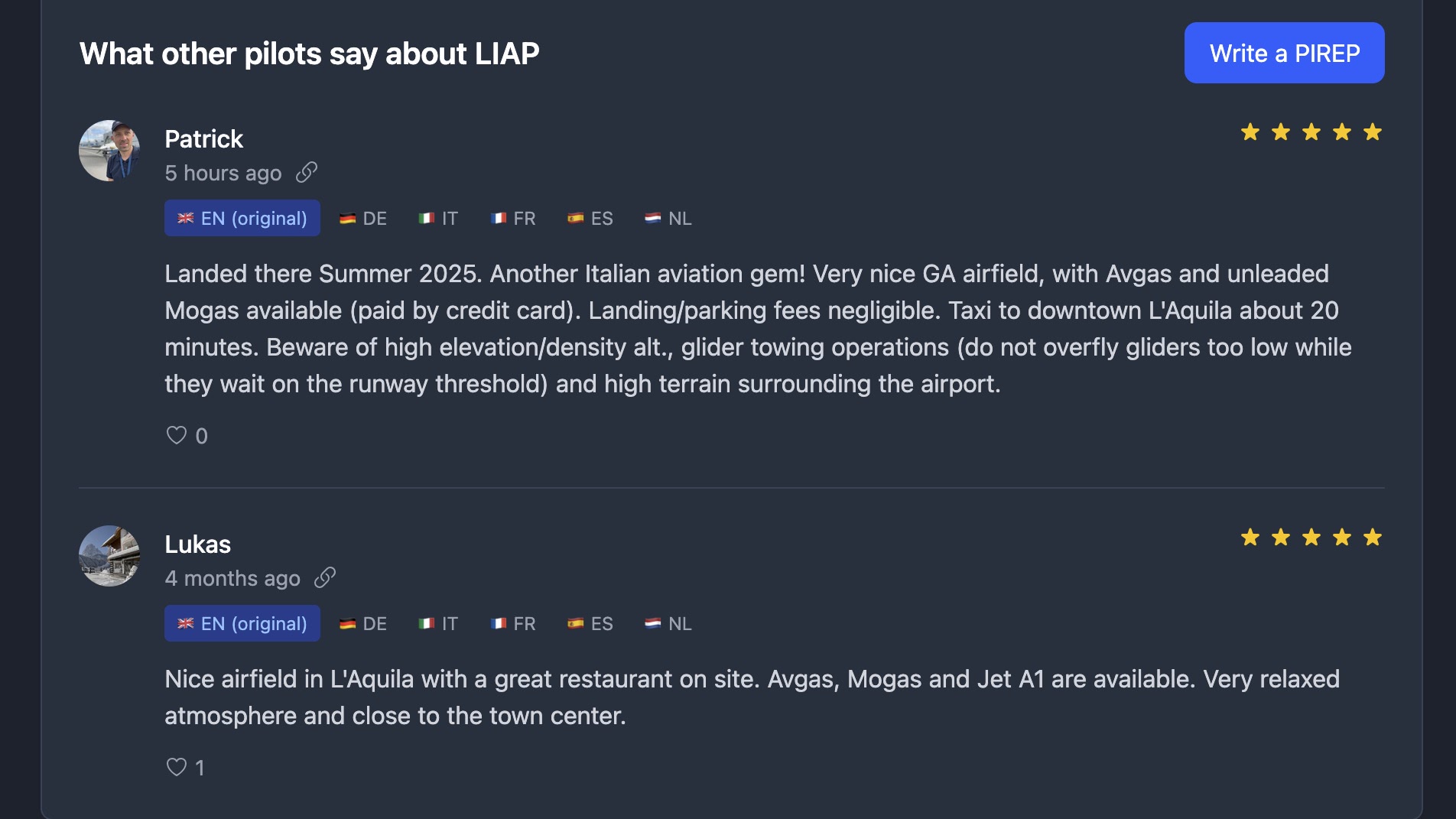
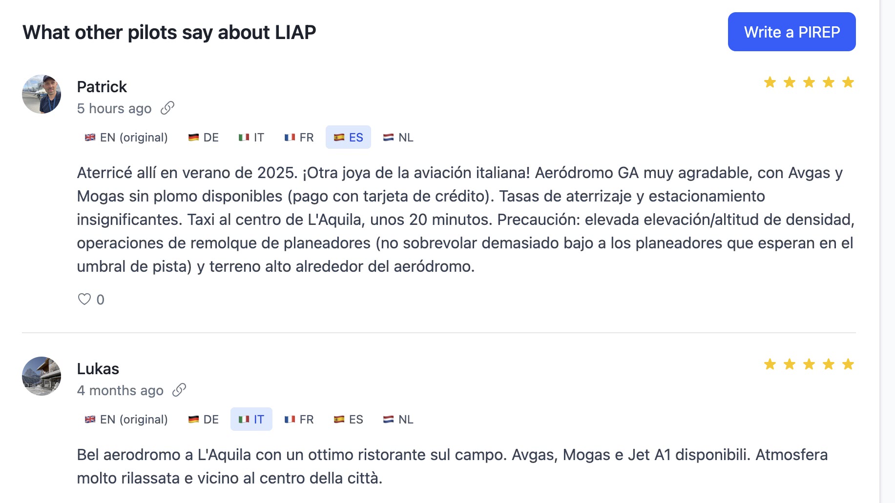
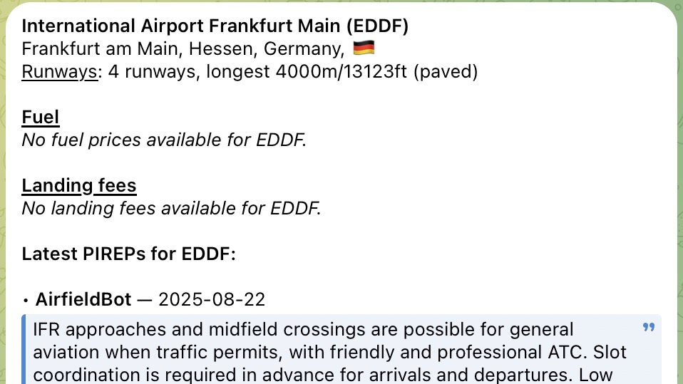
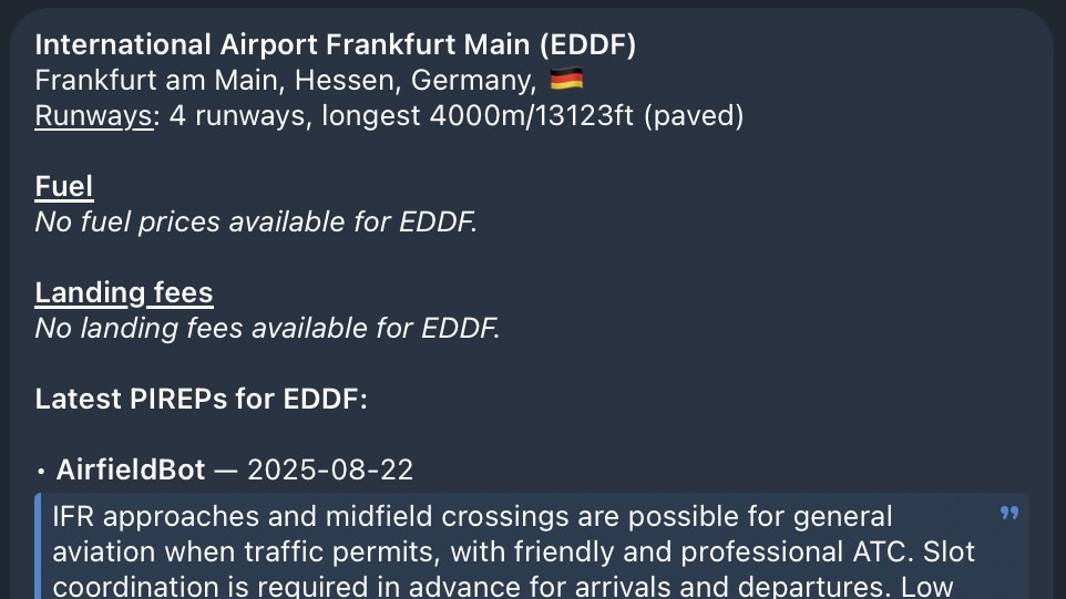
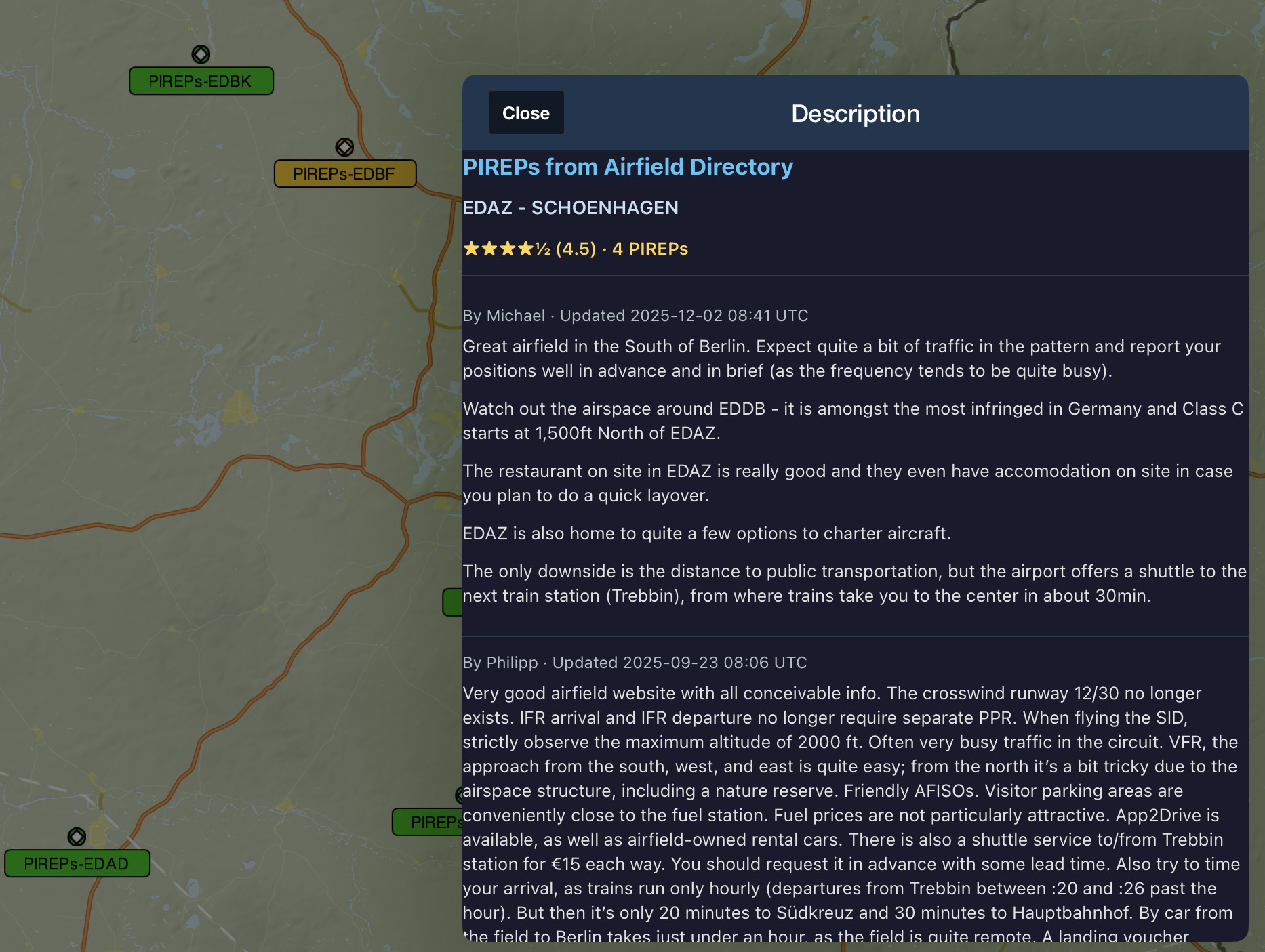
Pilot Comments
Access thousands of pilot comments licensed under CC BY-SA 4.0. Share your experiences, help fellow pilots, and benefit from real-world insights about airfields worldwide. Subscribe to the newest reports via RSS.
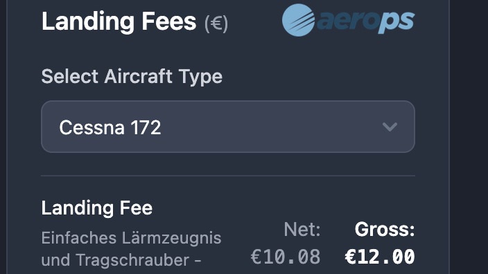
Landing Fees & Fuel Prices
Get personalized landing fee estimates for your aircraft via Aerops integration. Set your tailsign in your profile and see accurate pricing across supported airfields.
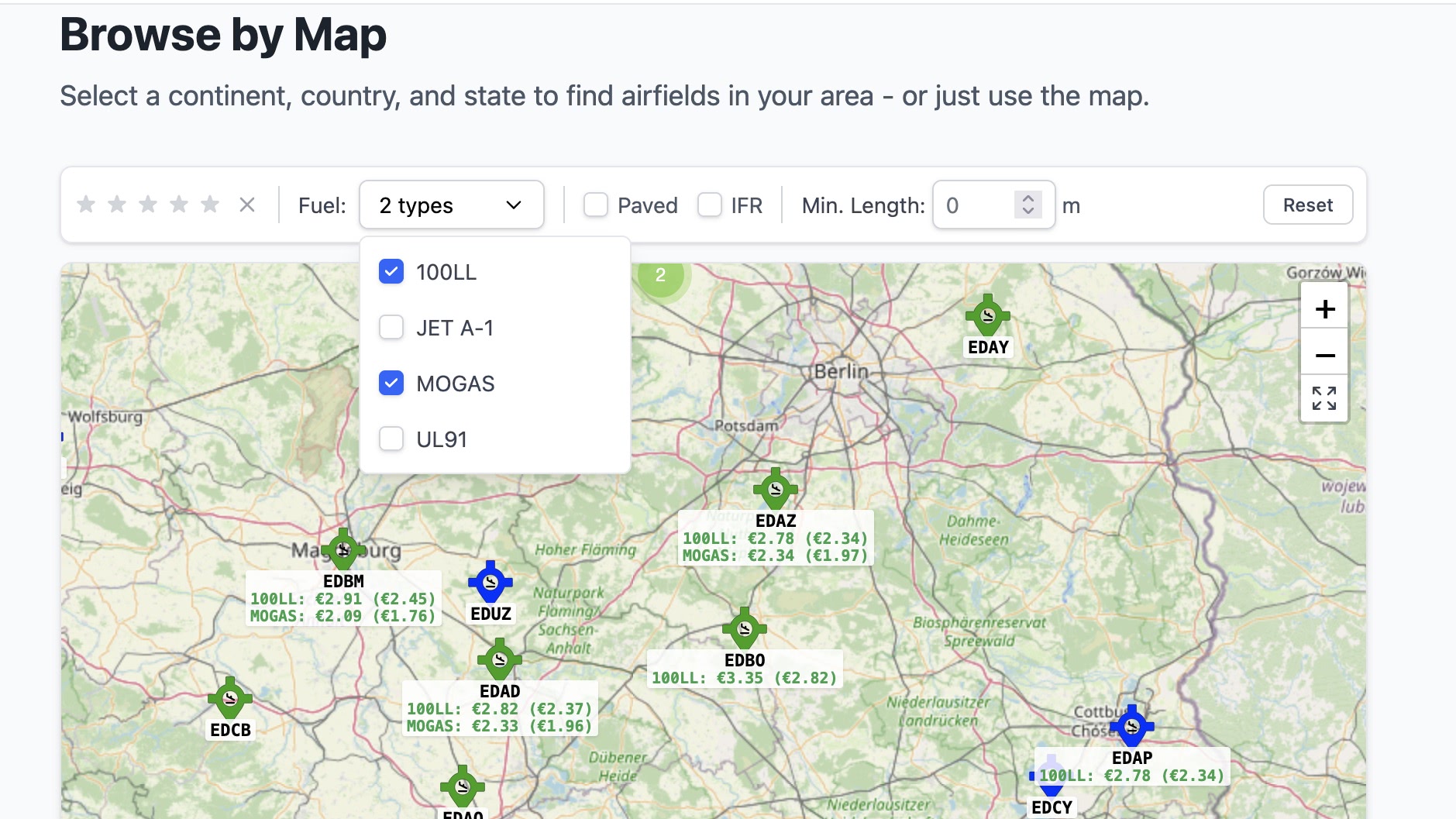
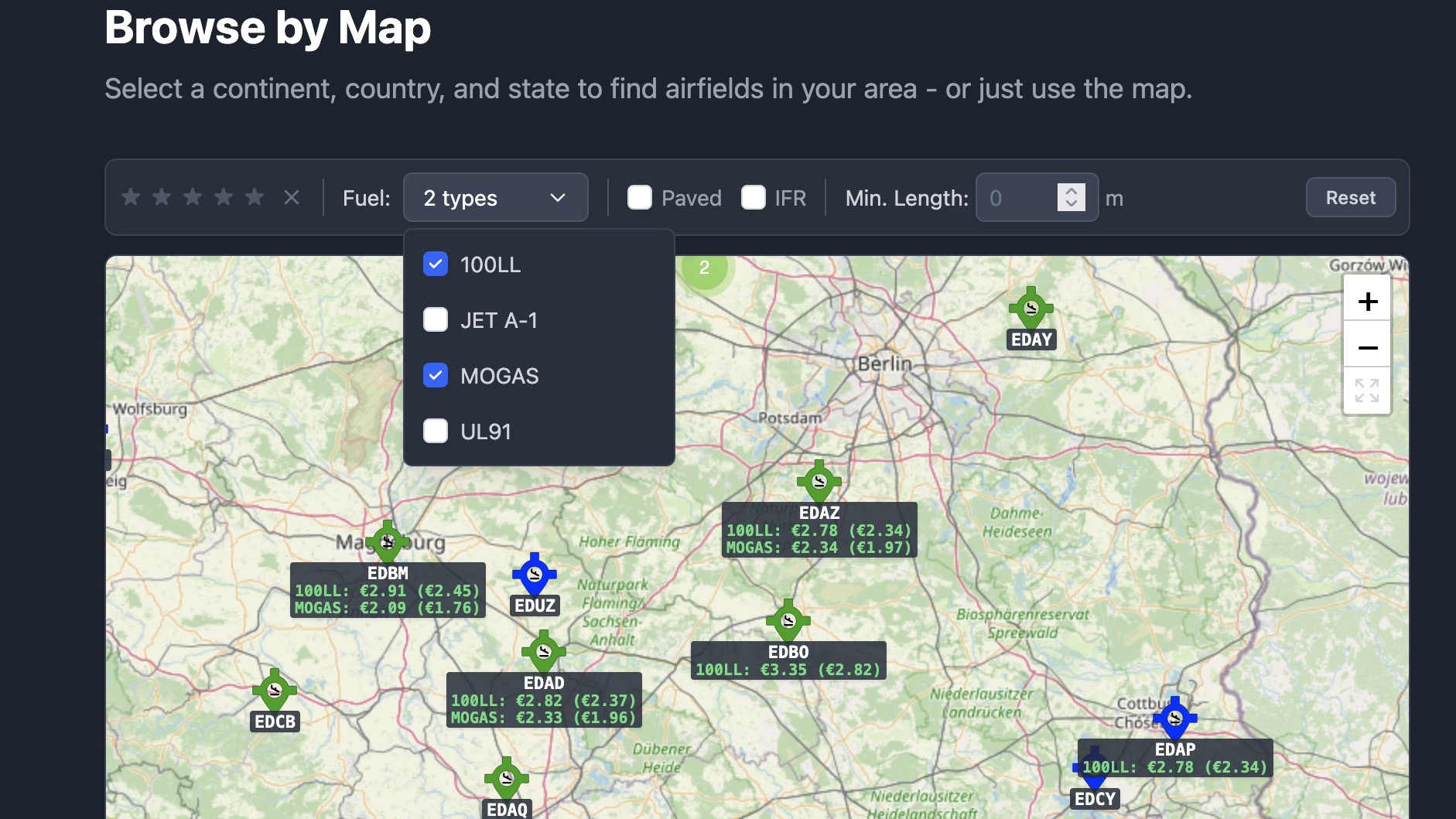
Interactive Map
Browse airfields visually with powerful filters. Filter by runway length, surface type, IFR capability, fuel availability, and more. Find any place instantly — search by ICAO code, landmark, city, or address with smart autocomplete. Plan multi-leg routes with great circle navigation: add aerodromes to your route, see each segment's distance in nautical miles with quarter-way markers, and track your total trip distance at a glance. Works great on mobile in fullscreen.
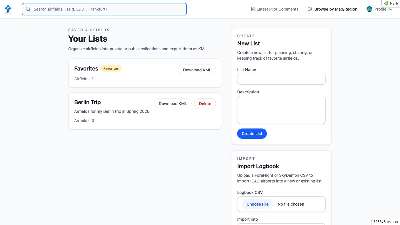
Powerful Lists
Organize airfields into custom collections. Save your favorites, plan trips, and share lists publicly. Import airfields from your ForeFlight or SkyDemon logbook and export any list as KMZ, e.g. for ForeFlight or Google MyMaps.
Auto-Translation
Pilot comments are automatically translated into 6 languages. Choose your preferred language or use language subdomains for a localized experience across the entire site.
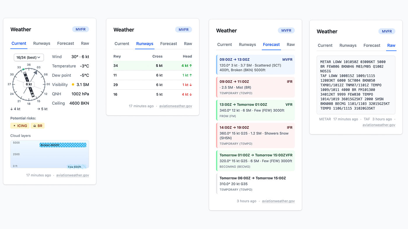
Live Aviation Weather
Real-time METAR and TAF data with intelligent hazard detection. See the best runway for current wind, visualize cloud layers at a glance, and review potential hazard advisories for icing, low visibility, wind shear, and other risks decoded from aviation weather reports. Flight categories (VFR, MVFR, IFR, LIFR) are color-coded on the map for a quick overview.
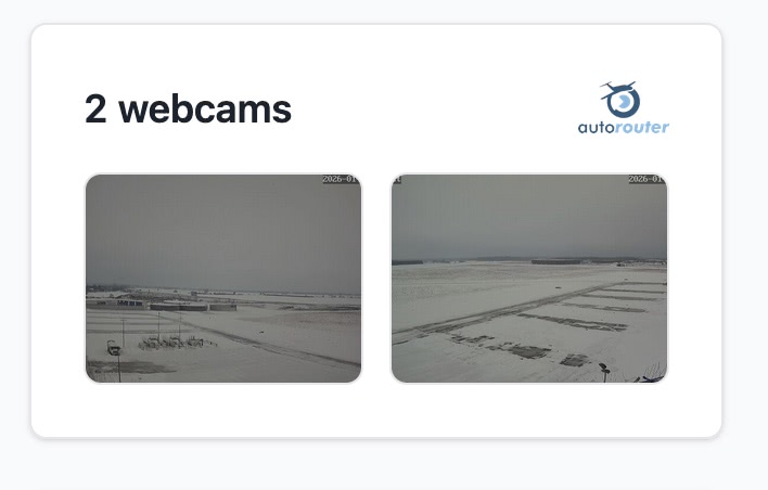
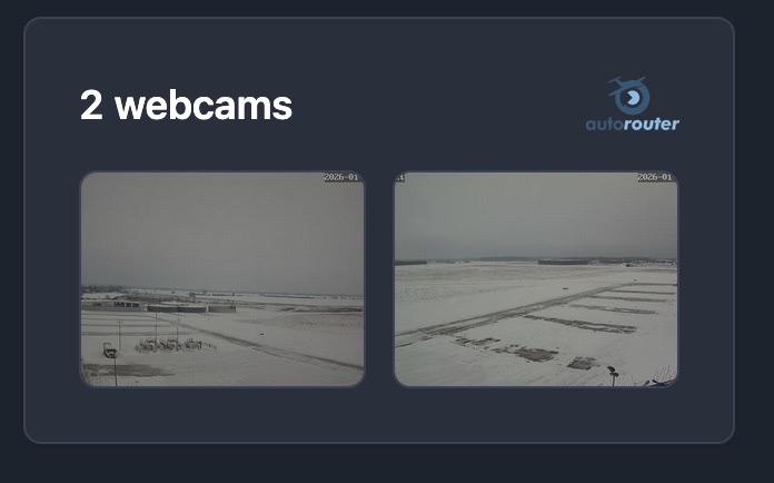
Live Airport Webcams
See real-time conditions at airports with integrated webcams from Autorouter and Windy. Get a visual glimpse before your flight with live and timelapse views.


Car Rental
Need a car at your destination? See real-time availability and prices from app2drive directly on the airfield page. Book a rental car with just a few clicks — prices update based on your flight times.
Telegram Bot
Quick airfield lookups and comment submission right from Telegram. Get fuel prices, landing fees, and submit reports without leaving your favorite messenger.


Free & Private
No ads. No tracking. No subscription. Airfield Directory is and will remain completely free. We respect your privacy and never sell your data.
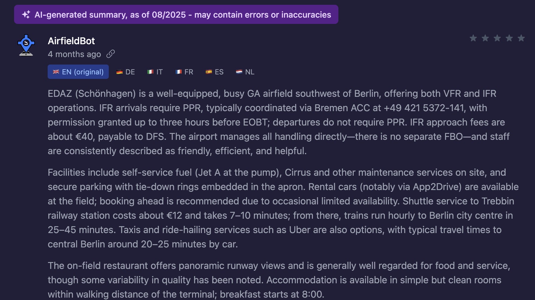
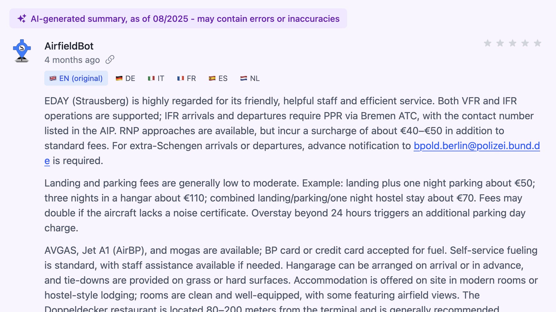
AI Summaries
For airfields without community reports, we provide AI-generated summaries to give you a starting point. Clearly labeled so you know what's human-written.
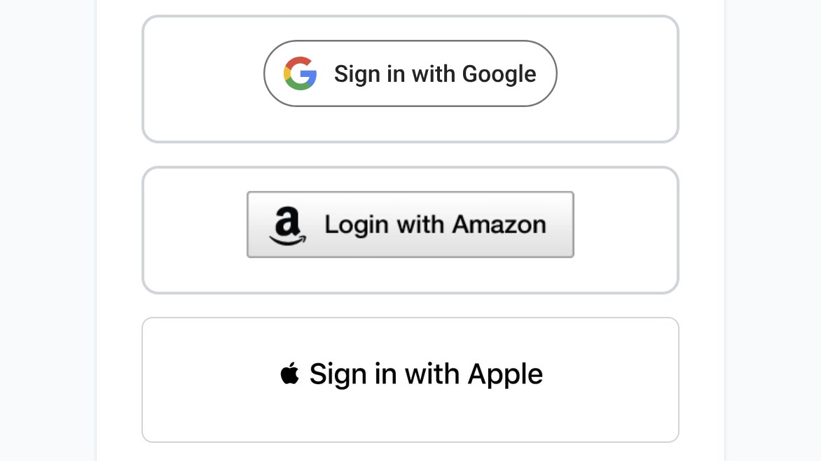

Easy Sign-Up
No password to remember. Sign in with your Google, Apple, or Amazon account. Your existing account works across all three providers.
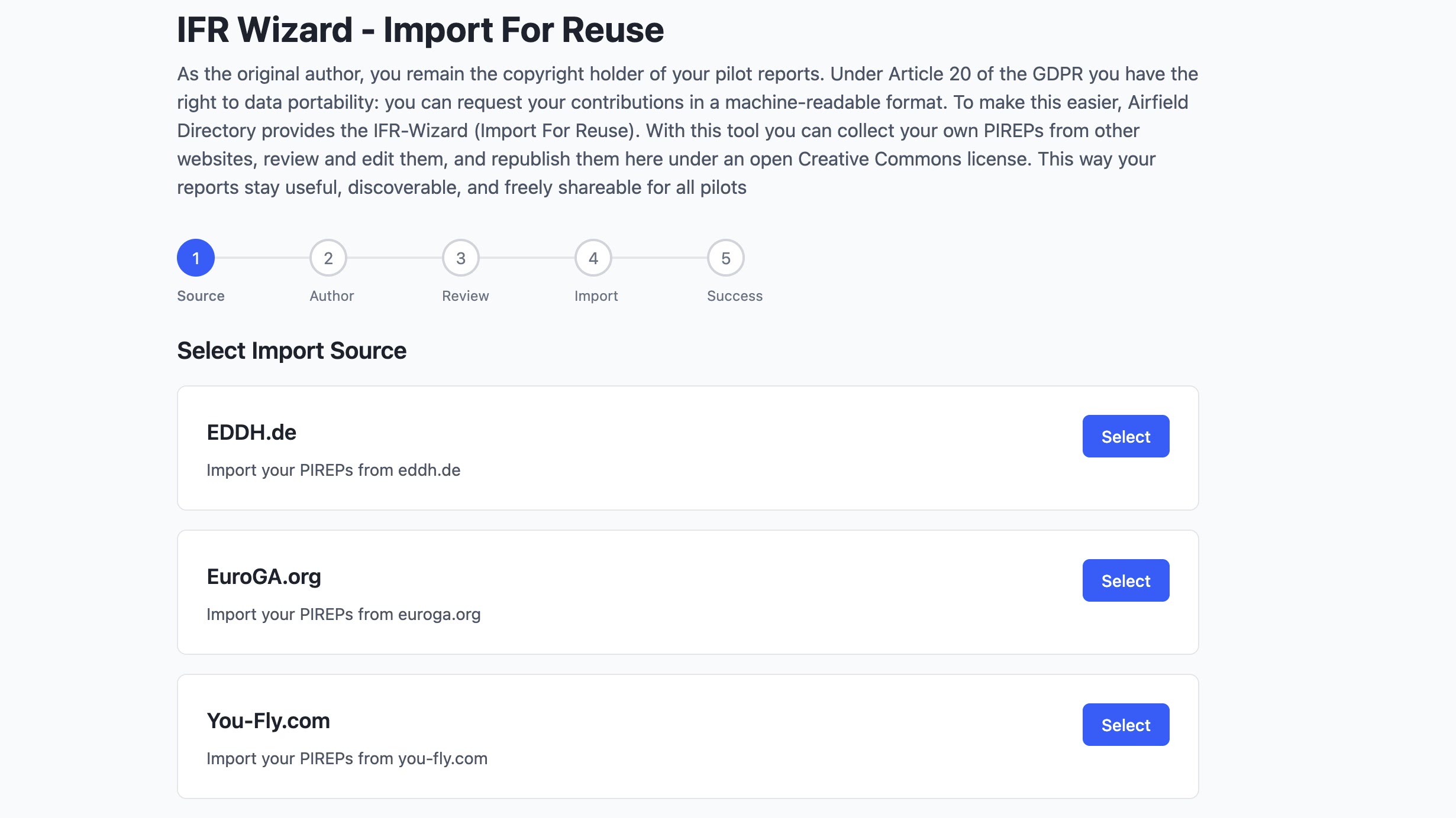
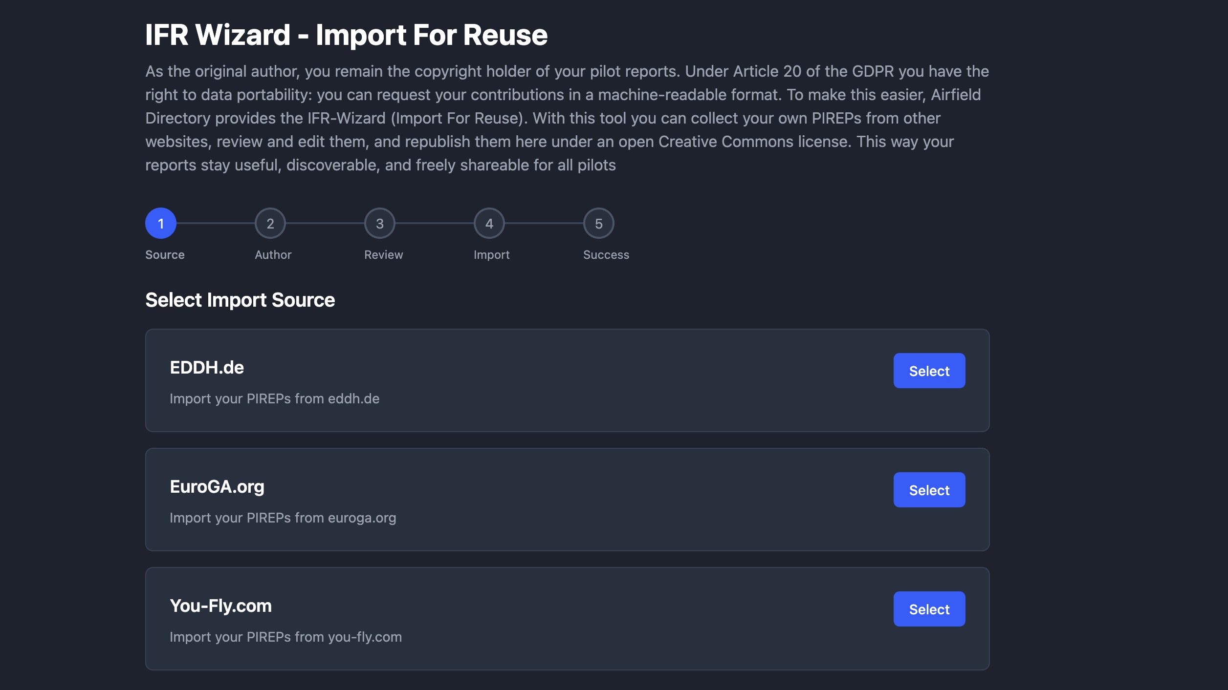
IFR Wizard
Import your historical PIREPs from other aviation websites and republish them under an open license. Your contributions become freely available to all pilots.
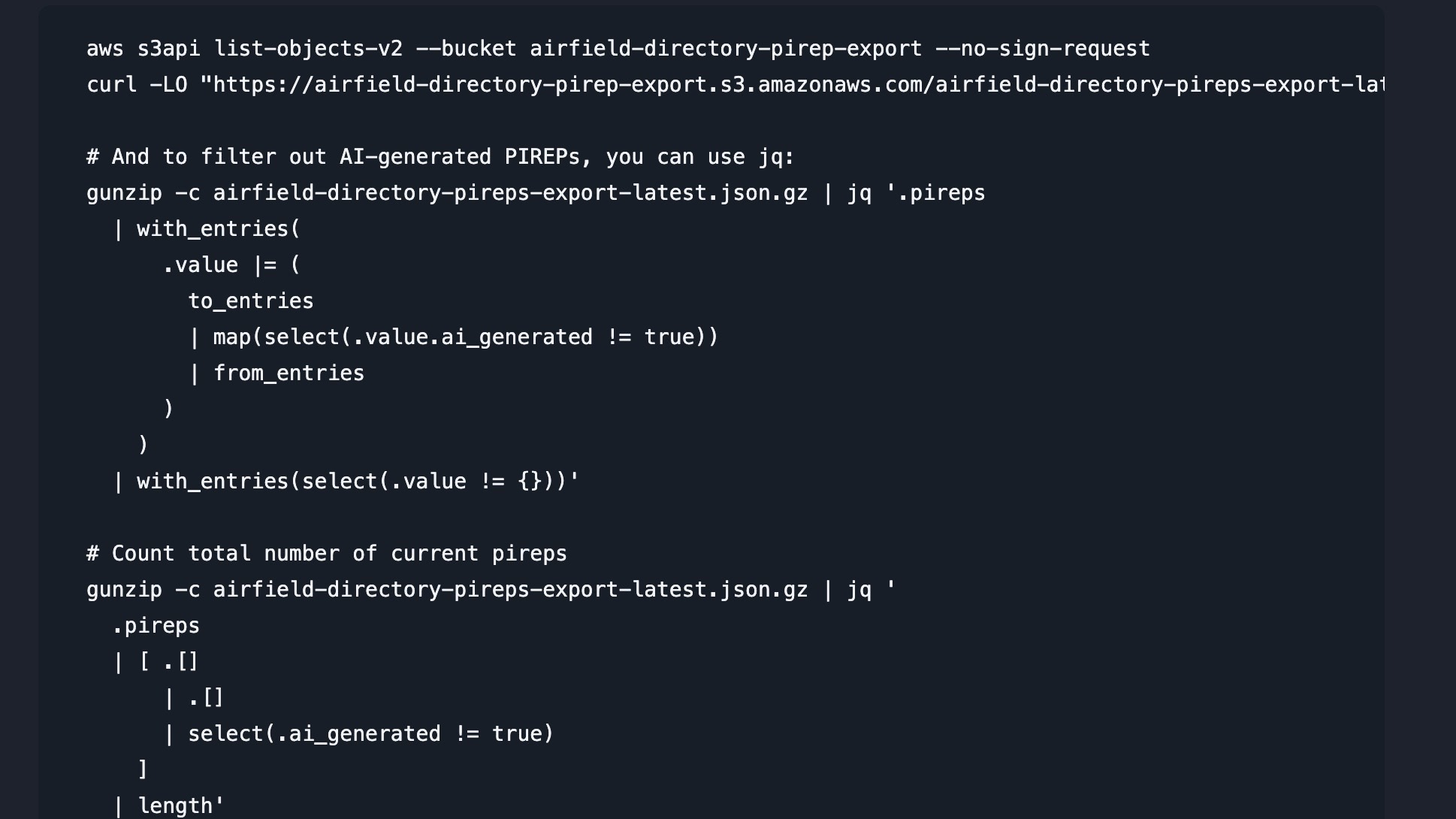

Open Data API
Build on our data. Access airfield information via JSON endpoints, RSS feeds, or bulk download complete datasets from our S3 bucket. Perfect for developers and aviation apps.


MCP Server for AI Assistants
Connect your AI assistant directly to our airfield data. Our public MCP server works with Claude, ChatGPT, Codex, and Gemini -- no authentication required. Search airfields, get weather, check webcams, and browse pilot reports through natural conversation.
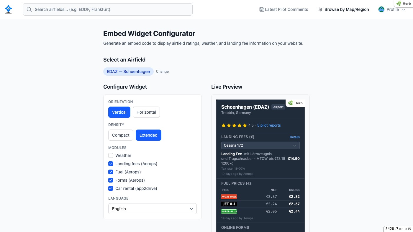
Embeddable Widgets
Display live airfield data directly on your website. Embed ratings, weather, landing fees, and fuel prices with a simple code snippet. Choose vertical or horizontal layout, compact or extended density, and 6 languages.

ForeFlight Content Packs
Export Airfield Directory PIREPs as ForeFlight content packs. Download a ZIP and AirDrop it to your iPad, or connect our S3 bucket in ForeFlight Web. Human-only and with-AI variants are available for every locale.
Trusted Data Foundation
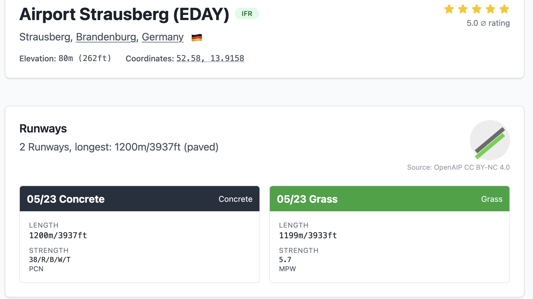
Our airfield database combines FAA data for US airfields with OpenAIP and OpenFlightMaps community data for the rest of the world, and we enrich it with pilot comments, pricing, and real-world context. Beyond the basics — runway lengths, fuel availability, IFR capability, private/PPR status, elevation, and coordinates — we also curate official customs and immigration sources, lists, and websites to surface the information that matters most to visiting pilots, including operating times, ground contact details, phone numbers, and email addresses.
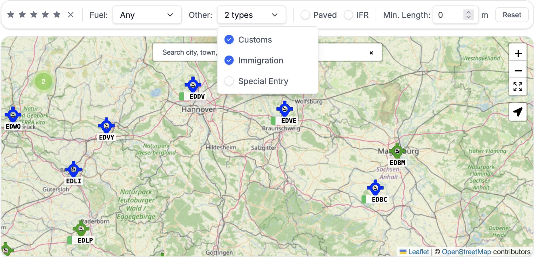
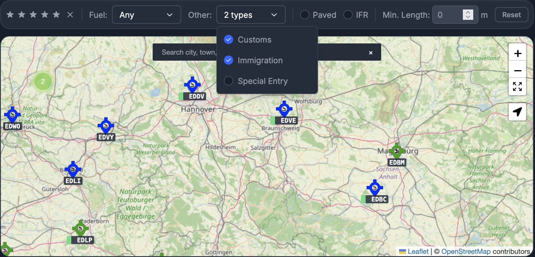
Customs & Immigration
Know where you can legally clear customs and immigration before you cross a border. We show availability for US, UK, Swiss, German, and other European airfields — each linked to the official government source: US CBP for the United States, UK Border Force via the GAR Annex A list for the United Kingdom, Swiss BAZG for Switzerland, Zoll (§ 22a "besondere Landeplätze" and the full Zollflugplätze list) for Germany, and more. Use the map filters to find Customs, Immigration, and Special Ports of Entry — helpful when flying from the southern US border (19 CFR § 122.24), visiting Greece, or planning any cross-border GA trip where clearance is not a given.


CBP Fact Sheets
For every US airport of entry that publishes one, we link straight to the official CBP General Aviation Airport Fact Sheet — the same PDF CBP hands to visiting pilots, with clearance procedures, hours, phone numbers, and any airport-specific quirks. We track the CBP index, cache new and updated fact sheets as they're published, and expose the most recent document on the airfield page so you don't have to go hunting on cbp.gov before a border crossing.